The Importance and Process of Boundary Surveys | Corona, CA

image of the architectural project engineer. Vintage tone and engineering tools in the workplace.

Boundary surveys arguably provide one of the most important pieces of information a prospective property owner can gather. When properly performed, a boundary survey will allow a current or prospective property owner to understand the exact coordinates of their property line so he or she may build their structure with confidence and identify potential encroachments. Not only would an owner not want to extend beyond their property line, but should someone encroach upon theirs, the results of this survey may become an important piece of evidence in court.

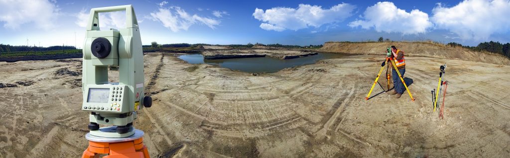
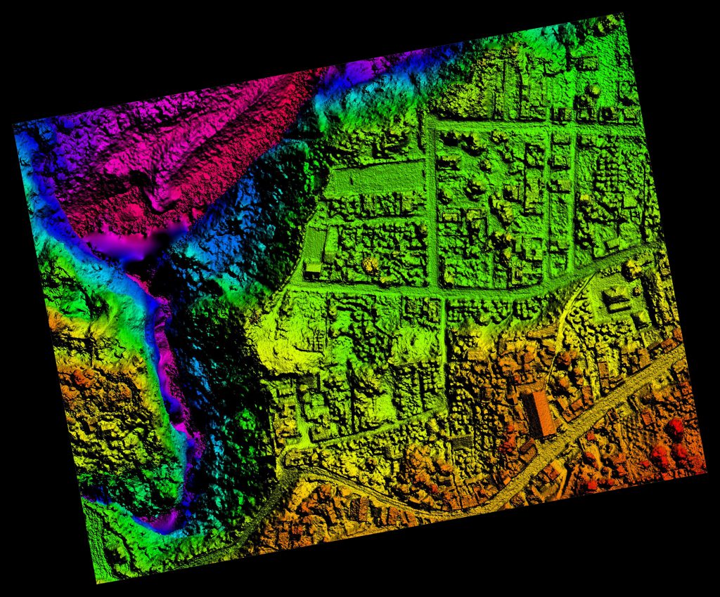
So, how are boundary surveys conducted? Our team of experienced professionals begins by acquiring all the necessary documentation required to conduct research and pre-calculations. Once they have a general understanding of the area, a field crew visits the site to assess existing monumentation and conduct survey measurements. That information is then passed along to our office staff to review and determine boundary coordinates. The results of that determination then go back to the field crew who then set the property’s corners and prepare a Record of Survey.

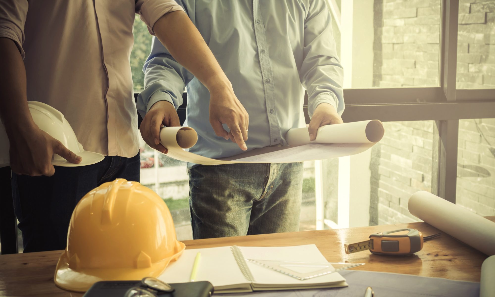
The Record of Survey is then filed with the County Surveyor and results are provided to the property owner. We pride ourselves on providing high-quality boundary mapping services. Our clients can proceed with confidence knowing that their property corners are located accurately.

To learn more about boundary surveys, please contact us at (800) CALVADA or visit www.calvada.com.

Calvada proudly serves Corona and all surrounding areas.

How Weather Can Affect Your Land Survey | Corona, CA

When it comes to land surveying, there are plenty of obstacles that can come into play during a typical day at work. One of these obstacles is the weather, especially during the winter season. It may seem like living in Southern California, an area that is 95% sunny day, wouldn’t be an issue, but you would be surprised – we have our own set of weather issues.

In the spring season, rain can always be an issue, and even though it isn’t a common occurrence, the sporadic nature of our rain season can make things tricky. Dressing appropriately will not only keep you dry, but also safe. And the same goes for your equipment. Because surveying is an outdoor job, everything and everyone needs to be protected. After the rain comes mud, so additional caution needs to be paid in work zones.

If you work in the winter season, there is a chance you may be working in snowy conditions. The problem is that it is likely covering up what you need to be surveying, like dangerous obstacles and essential sights such as property corners, flagging, and downed fences that you need to see to be able to complete your work.

Some may think the job is easier in this sunny climate, but the sun can often play tricks by creating shadows where you don’t want them. And let’s face it – the Santa Ana winds are a strong force to reckon with. Not only is it tough to stand in one place, but a workstation can easily become unlevel. Surveying is all about working around Mother Nature’s plans.

Remember: We may live in Southern California, the land of sunny days, but it can become quite extreme. You and your equipment have their limits.

To find out more about how weather can affect land surveys, please contact us at (800) CALVADA or visit www.calvada.com.

Calvada proudly serves Corona and all surrounding areas.

The Environmental Industry Needs Land Survey Services | Corona, CA

In this day and age, it is important that we do everything we can to create a more sustainable way of living on this planet. This being said, when designing or constructing a building, a bridge, a water pipeline or any infrastructure asset, it is important to get a land survey to find out if what you’d like to develop is actually feasible.

A land survey is generally required when designing or constructing structures such as buildings, roads, parking lots, utility corridors, or athletic fields, etc. Why? Because these surveys can give detailed account of horizontal and vertical dimensions and elevations of the structure in question, and also show above ground attributes such as utilities, access roads, parking spaces, fences, etc. More specifically, land survey deliverables for the Environmental Industry include:

  • Geotracker surveys on newly installed groundwater monitoring wells
  • Earth quantity calculations used to determine the amount of contaminated dirt to be removed
  • Topographic surveys for any environmental infrastructure design project
  • Construction staking for any environmental project that is being built from the ground up

To find out more about land surveys, please contact us at (800) CALVADA or visit www.calvada.com.

Calvada proudly serves Corona and all surrounding areas.

When Considering the Purchase of an Empty Plot of Land | Corona, CA

When purchasing a building, it is natural to get a survey done to flag any issues the edifice has prior to signing any agreement. When it comes to a plot of vacant land, it is natural to think a survey isn’t necessary as the land is empty. Unfortunately, there are things about this plot of land you may not be able to see by just walking it and only a certified land surveyor can give you those answers.

An ALTA/ASCM survey (American Land Title Association/American Congress on Surveying and Mapping) is the most comprehensive survey and is commonly recommended to the purchaser. Table A is a specific set of ALTA survey options you may want to know about, like flood zones or your neighbors. As you can see, this survey will not only show property lines, but easements, encroachments or other boundary issues that may affect your property or how the land is developed.

An easement is created when a landowner grants another party permission to use a certain portion of land for a specified purpose. This type of occurrence could be anything from a shortcut through the property to access to certain amenities. The details of these easements on the property, not the agreement itself, will be included in the survey.

An encroachment is a property improvement that partially lies on an adjacent property, without the adjacent owner’s permission. An example of this would be fencing meant to designate property lines that partially falls on the neighbor’s property in areas.

Once a survey is conducted, you can approach a purchase with more knowledge about what you are purchasing. If there are issues, they can be negotiated in order to prevent buyer’s remorse.

To find out more about purchasing land, please contact us at (800) CALVADA or visit www.calvada.com.

Calvada proudly serves Corona and all surrounding areas.

There Are Benefits to Hiring Topographical Surveyors | Corona, CA

In the time of buying land or property, you or your agent should be in contact with topographical surveyors in order to educate you about the property territories and lines. From installing the fence to the land survey, surveyors will help you determine the topographic layout to make the correct decisions as a homeowner.

Topographic surveys will provide numerous benefits:

Your soil. Topographical surveyors can make you aware of your flood zone when you are buying a property. This will help you determine with your architect/engineer proper building parameters.       

Construction prep. Before starting construction, make sure you have already consulted a trained architect/engineer who will give you the green light. It’s important to check the soil to see if it is suitable for making a foundation. They will also check the underground water levels. These are all processes that an architect/engineer will go through before giving you their final opinion to begin construction.

Property value. Believe it or not, but topographical surveyors play a crucial role when purchasing or selling property and the reasons are pretty simple – if you are going to invest your hard-earned money, a topographical surveyor who will help you obtain the proper property information so an agent can help you to determine the value of the particular property.

It is fairly obvious that a topographical surveyor’s role in your land purchase/sale is a huge one, and thankfully, you can be secure in your purchases knowing that a professional is on your side. They are not only experts in their fields, but they will provide you with a plethora of benefits when you hire one. If you need a land surveyor for your property, contact Calvada Surveying, Inc.

To find out more about hiring topographical surveyors, please contact us at (800) CALVADA or visit www.calvada.com.

Calvada proudly serves Corona and all surrounding areas.