What Is the Importance of a Topographical Survey? | Corona, CA

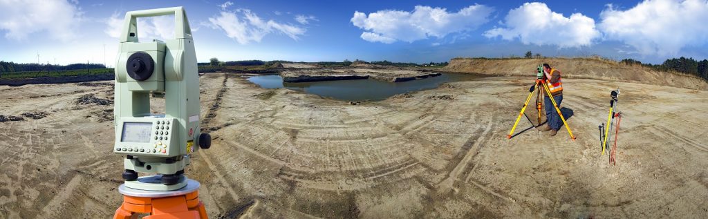
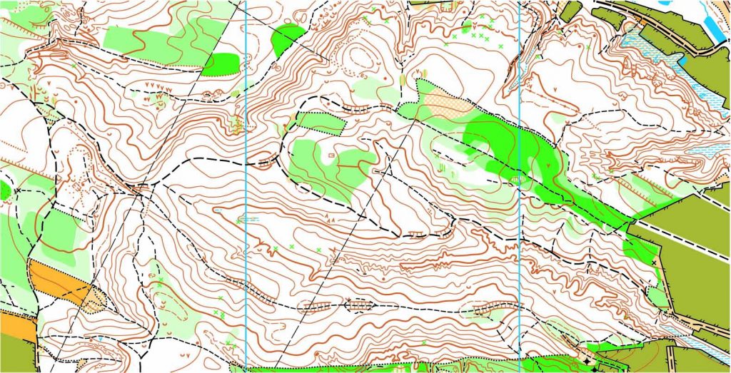
A topographic survey is different from other surveys by studying and measuring the surface of the land. Topographical survey measurements are carried out using both GPS or Global Positioning System and Electronic Distance Metering (EDM). The parcel elevation is shown on the map of the survey via contour lines representing the Earth’s surface’s contours and also via elevations at different spots on the map.

The topographic surveys refer to both natural and human-constructed surface characteristics such as storage walls, gas lines, wells, trees, lakes, closed spaces, buildings, utility poles, etc.

But who really needs a survey like this? Architects could use this type of survey for the construction of a 3D plot of their design. If a building site is limited by significant topographical challenges, such as steep grades, existing man-made structures or other problematic conditions, a topographical inspection is ideal in order to ensure that the design proposed will work under these conditions before construction starts.

Government agencies also use topographical surveys to produce, implement, evaluate existing infrastructure, carry out required revisions and consider environmental projects, and implement the Construction and Zoning Regulations.

And yes, these types of industries would definitely need something like this, but how about the average layman? Do these surveys come in handy? Yes. If you are planning a garden or what to do with some property you own, this survey aims primarily to gather data on the characteristics of the land and its altitude.

Topographic surveys for changes in ownership of the property or land, known also as contour surveys, must be conducted before the owner makes changes. Safety is also an extremely important reason for topographic surveys. Inaccurate, incomplete or old underground records may jeopardize your projects.

To find out more about topographical surveys, please contact us at (800) CALVADA or visit www.calvada.com.

Calvada proudly serves Corona and all surrounding areas.

Why We Need to Survey Land | Corona, CA

We all know that in order to develop land, you need to know the boundary lines in which you can expand and what kind of land you are trying to develop. This is when a land survey comes in handy. Not only do surveys help plot out the land but surveyors are used in the design and planning of said land to make room for things like roads, utilities and landscaping. It may seem like a new concept, but surveys have been needed since the beginning of civilization.

Land surveys have dated back thousands of years to Egyptian surveyors dividing land along the Nile River and Australian surveyors trying to design their early settlements. Even famous explorers like Burke and Wills used their surveying background in their work. Yes, the tools and equipment may have changed over the years, but we’ve needed land surveying for as long as we’ve had land to develop.

But why are they so intricate to creating our structures? It isn’t just about plotting open spaces to place buildings and other structures upon. Surveyors work with lots of other important industries like engineering, geology, architecture and planning in order to create a successful construction site. They measure the land and map it all out before anyone even steps foot on the site. These findings are given to the architects, who create a blueprint based on the needs of the client. Once complete, engineers use those plans to create a structure that will be successful based on the land available. So, as you can see, land surveys are the environmental trackers of structural design.

To find out more about considering a land survey, please contact us at (800) CALVADA or visit www.calvada.com.

Calvada proudly serves Corona and all surrounding areas.

Land Surveys: Are They Necessary? | Corona, CA

When deciding to purchase land it is important to know what you’re buying into, just like any other major investment. How large is the area, what kind of terrain is involved, and what does the surrounding area consist of? To find these answers, it is likely that you’ll need a land survey. I know what some may think – but is a survey really necessary?

When new land is being divided into various developments, it is important to have the land surveyed in order to ensure the land is used beneficially. Not only do surveys help plot out the land but surveyors are used in the design and planning of said land to make room for things like roads, utilities and landscaping. Yes, it may seem like a new-found industry, but we’ve needed land surveying for as long as we’ve had land to develop.

But why are they so intricate to creating our structures? Believe it or not, but it isn’t just about plotting open spaces to place buildings and other structures upon. Surveyors work with lots of other important industries like engineering, geology, architecture and planning in order to create a successful construction site. They measure the land and map it all out before anyone even steps foot on the site. These findings are given to the architects, who create a blueprint based on the needs of the client. Once complete, engineers use those plans to create a structure that will be successful based on the land available. So, as you can see, land surveys are the environmental trackers of structural design.

To find out more about considering a land survey, please contact us at (800) CALVADA or visit www.calvada.com.

Calvada proudly serves Corona and all surrounding areas.

The Benefits of a Land Survey | Corona, CA

When looking to purchase a plot of land, it is important to know what you’re buying. Unfortunately, this isn’t something that can be seen with the naked eye. There are property lines and various other factors that all play a part in purchasing land in order to build upon it. This is where land surveys come into play. Before you buy land, you want to know how large it is. To find this out, you need to know the precise property lines to determine a plot of land’s acreage and value. Here are a couple of others you may want to consider:

Does it fit your needs?

Your purchase is going to depend on what you want to build on it. If you want to build a house, you don’t want sloped land, but if you want to build a winery, you would for drainage. Having the survey done will not only point out the slope but the directions of the slope.

Yes, even the direction of the slope can matter. People who farm need to pay close attention to whether sloped land faces north or south.

Where can you build?

Building structures like houses, barns, and sheds can improve the land’s usefulness and value significantly. You need to know the location of underground pipes and utility lines. Without that knowledge, you could break ground on a major waterline.

A land survey provides the information that you need to choose the right locations for your structures. What you learn about your land could help you save money and finish your construction project faster.

To find out more about considering a land survey, please contact us at (800) CALVADA or visit www.calvada.com.

Calvada proudly serves Corona and all surrounding areas.