Topographic Surveying: A Guide | Corona, CA

topographic map

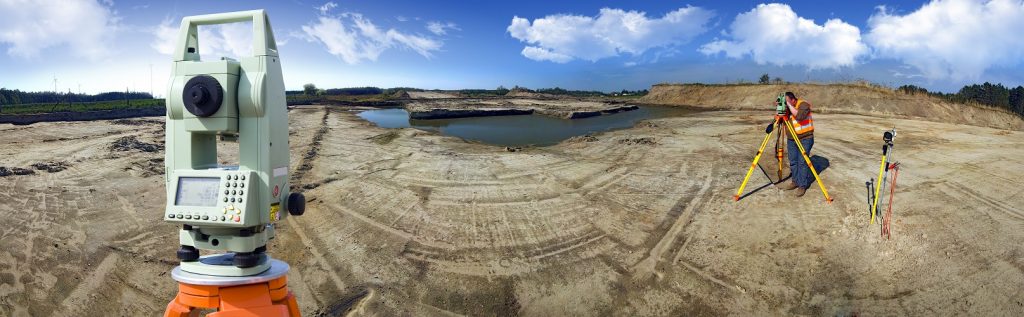
The topography of a space refers to the arrangement of the natural and artificial physical features of an area. Conducting a survey on that area allows one to understand the existing conditions of a site, the contours, locations, and elevations of the space.

The Role it Plays

Conducting a topographic survey before starting any kind of change to the site is paramount to your ability to do so properly. Engineers, developers, architects, and telecommunication providers all rely on the information provided by a topographic survey to understand how they must proceed with any desired improvements you seek.

How Cal Vada can Help

When you work with the experienced professionals on the Cal Vada team, our surveyors will visit the site and employ the highest quality methods with the latest technology. Our team will establish the horizontal and vertical controls of the space, and locate all surface improvements such as curbs and gutters, as well as all other improvements that may exist on the site. In an open space, we will observe surface contours and underground pipe invert elevations for all drain inlets, storm drain manholes, and sewer manholes.

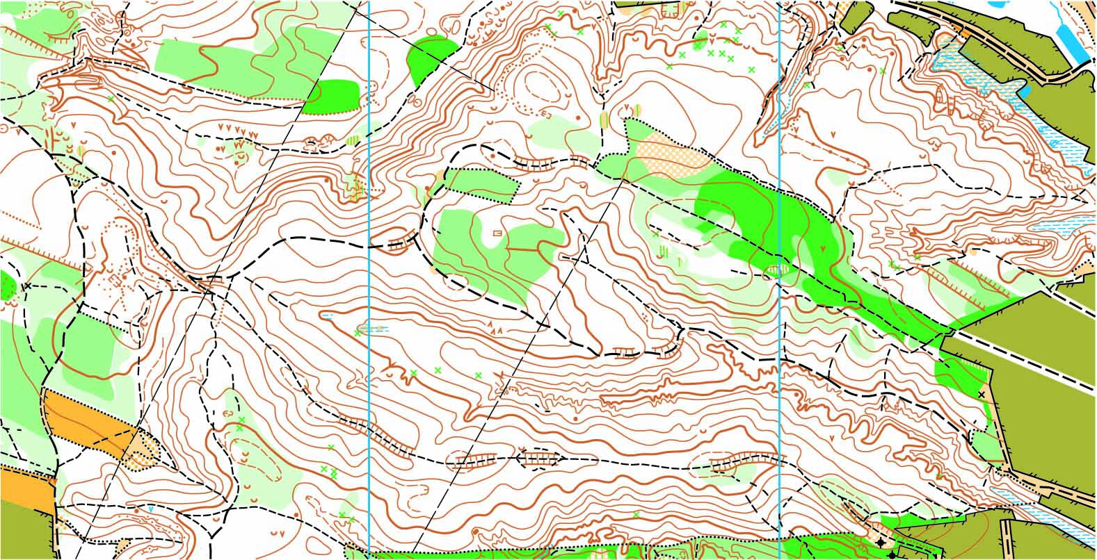
Once collected, this data is processed by our office staff to produce a high-quality AutoCAD Civil 3D image of the space. Exhibits are prepared in PDF format which provides a clean and precise vision of the site’s existing conditions.

To learn more about topographic surveys, please contact us at (800) CALVADA or visit www.calvada.com.

Calvada proudly serves Corona and all surrounding areas.

The Environmental Industry Needs Land Survey Services | Corona, CA

In this day and age, it is important that we do everything we can to create a more sustainable way of living on this planet. This being said, when designing or constructing a building, a bridge, a water pipeline or any infrastructure asset, it is important to get a land survey to find out if what you’d like to develop is actually feasible.

A land survey is generally required when designing or constructing structures such as buildings, roads, parking lots, utility corridors, or athletic fields, etc. Why? Because these surveys can give detailed account of horizontal and vertical dimensions and elevations of the structure in question, and also show above ground attributes such as utilities, access roads, parking spaces, fences, etc. More specifically, land survey deliverables for the Environmental Industry include:

  • Geotracker surveys on newly installed groundwater monitoring wells
  • Earth quantity calculations used to determine the amount of contaminated dirt to be removed
  • Topographic surveys for any environmental infrastructure design project
  • Construction staking for any environmental project that is being built from the ground up

To find out more about land surveys, please contact us at (800) CALVADA or visit www.calvada.com.

Calvada proudly serves Corona and all surrounding areas.

There Are Benefits to Hiring Topographical Surveyors | Corona, CA

In the time of buying land or property, you or your agent should be in contact with topographical surveyors in order to educate you about the property territories and lines. From installing the fence to the land survey, surveyors will help you determine the topographic layout to make the correct decisions as a homeowner.

Topographic surveys will provide numerous benefits:

Your soil. Topographical surveyors can make you aware of your flood zone when you are buying a property. This will help you determine with your architect/engineer proper building parameters.       

Construction prep. Before starting construction, make sure you have already consulted a trained architect/engineer who will give you the green light. It’s important to check the soil to see if it is suitable for making a foundation. They will also check the underground water levels. These are all processes that an architect/engineer will go through before giving you their final opinion to begin construction.

Property value. Believe it or not, but topographical surveyors play a crucial role when purchasing or selling property and the reasons are pretty simple – if you are going to invest your hard-earned money, a topographical surveyor who will help you obtain the proper property information so an agent can help you to determine the value of the particular property.

It is fairly obvious that a topographical surveyor’s role in your land purchase/sale is a huge one, and thankfully, you can be secure in your purchases knowing that a professional is on your side. They are not only experts in their fields, but they will provide you with a plethora of benefits when you hire one. If you need a land surveyor for your property, contact Calvada Surveying, Inc.

To find out more about hiring topographical surveyors, please contact us at (800) CALVADA or visit www.calvada.com.

Calvada proudly serves Corona and all surrounding areas.